Topographic maps are invaluable tools for navigating and understanding the terrain of our planet. Whether you're an outdoor enthusiast planning a hiking trip or a geologist studying the Earth's surface, topographic maps provide detailed information about elevation, landforms, and geographic features. In this article, we delve into the fundamentals of topographic maps, exploring how they are created, interpreted, and utilized across various fields.
What are Topographic Maps?
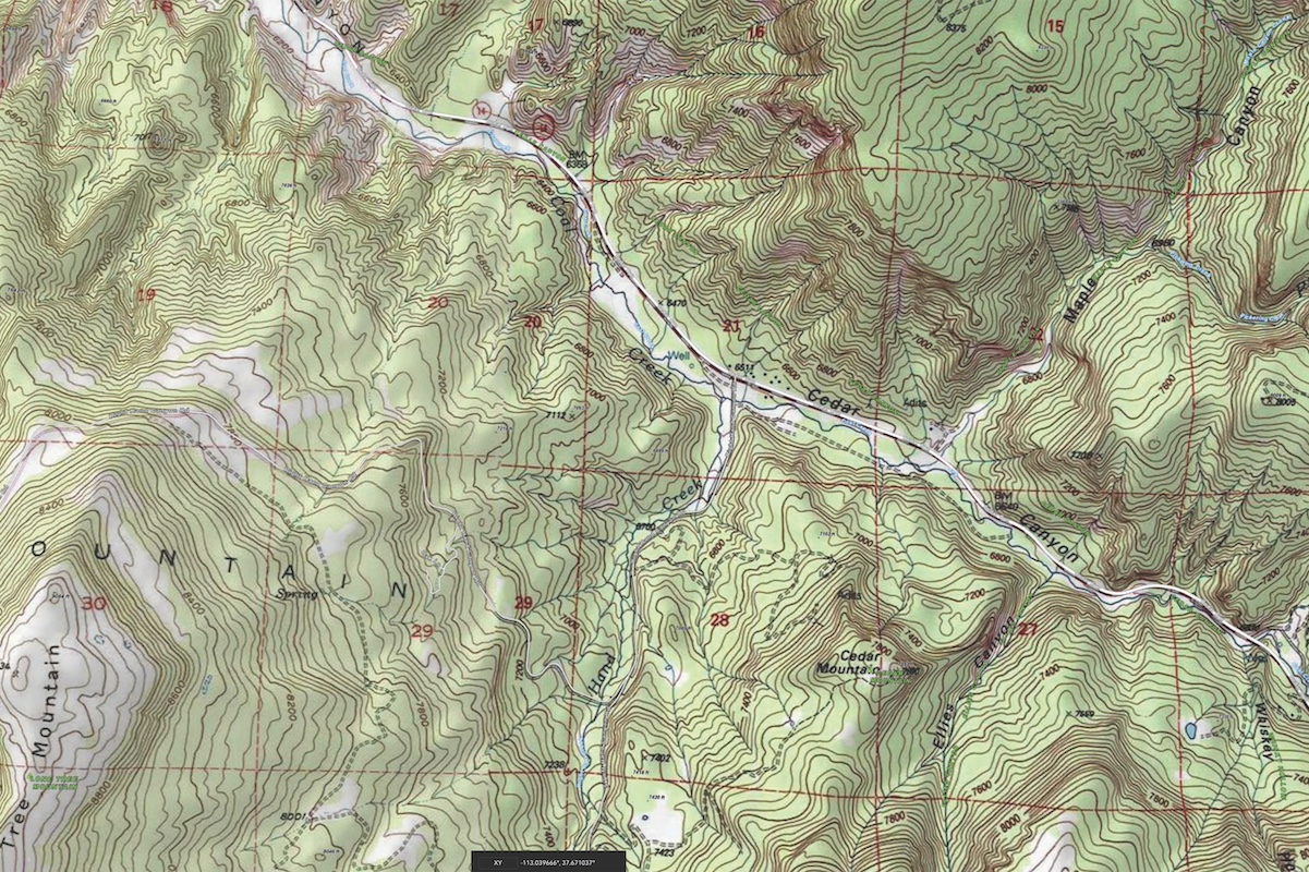
Topographic maps are detailed representations of the Earth's surface that depict the elevation and shape of the terrain through contour lines, symbols, and colors. Unlike traditional road maps, which focus on navigation, topographic maps provide a comprehensive view of the landscape's physical characteristics. They showcase features such as mountains, valleys, rivers, forests, and man-made structures, enabling users to visualize the topography of an area and plan activities accordingly.
Understanding Contour Lines:
Contour lines are the hallmark feature of topographic maps, representing lines of equal elevation above sea level. Each contour line connects points of the same elevation, creating a three-dimensional representation of the terrain. By interpreting contour lines, users can discern the steepness of slopes, the shape of valleys, and the height of peaks. Closer contour lines indicate steep terrain, while widely spaced lines suggest gentle slopes. Understanding contour intervals, which denote the elevation difference between adjacent contour lines, is crucial for accurately interpreting topographic maps.
Interpreting Symbols and Colors:
In addition to contour lines, topographic maps feature a variety of symbols and colors that convey additional information about the landscape. Symbols may denote landmarks, such as buildings, bridges, and campsites, as well as natural features like lakes, rivers, and glaciers. Colors are often used to differentiate vegetation types, bodies of water, and human-made structures. Understanding the legend or key provided on the map is essential for interpreting these symbols and colors correctly.
Applications of Topographic Maps:
Topographic maps find applications across a wide range of disciplines and activities. Outdoor enthusiasts rely on them for planning hiking, camping, and backpacking trips, as well as navigating unfamiliar terrain. Geologists use topographic maps to study the Earth's surface features, identify geological formations, and plan fieldwork. Urban planners utilize topographic maps for land use planning, infrastructure development, and flood risk assessment. Emergency responders rely on them for search and rescue operations, disaster response, and evacuation planning.
Creating and Using Digital Topographic Maps:
Advancements in technology have led to the development of digital topographic maps, which offer enhanced functionality and accessibility. Geographic Information Systems (GIS) software allows users to create, customize, and analyze topographic maps using digital data layers. Online mapping platforms provide interactive tools for viewing, annotating, and sharing topographic maps on computers, tablets, and smartphones. Digital elevation models (DEMs), derived from satellite imagery and LiDAR data, offer highly accurate representations of terrain for a wide range of applications.
Topographic maps are indispensable tools for understanding and navigating the Earth's diverse landscapes. By depicting elevation, landforms, and geographic features in detail, these maps provide valuable insights for outdoor enthusiasts, scientists, planners, and emergency responders alike. Whether exploring remote wilderness areas, conducting geological research, or planning urban developments, the knowledge gained from interpreting topographic maps enhances our understanding of the terrain and informs decision-making processes. As technology continues to evolve, digital topographic maps offer new opportunities for analysis, visualization, and collaboration, ensuring that we can navigate the terrain with confidence and precision.


