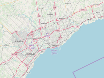
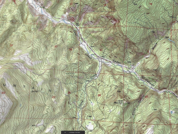
Geographic Information Systems (GIS) are powerful tools for capturing, analyzing, and visualizing spatial data to uncover valuable insights about our world. Whether you're a student, researcher, urban planner, or environmental scientist, understanding the basics of GIS can open doors to a wide range of applications and opportunities. In this beginner's guide, we'll explore the fundamentals of GIS, its key components, and how it is used to unlock geographic insights.
What is GIS? At its core, GIS is a system designed to capture, store, manipulate, analyze, manage, and present spatial or geographic data. Unlike traditional databases or spreadsheets, GIS software allows users to work with geographic data, such as maps, satellite imagery, and aerial photographs, in a dynamic and interactive manner. By combining geographic data with attributes, GIS enables users to visualize patterns, relationships, and trends that may not be apparent in tabular data alone.
Key Components of GIS:
GIS consists of several key components that work together to facilitate data management, analysis, and visualization:
- Geographic Data: Geographic data, also known as spatial data, includes information about the location and attributes of features on the Earth's surface, such as roads, rivers, buildings, and vegetation. Geographic data can be represented in various formats, including points, lines, polygons, and raster images.
- Software: GIS software provides tools and functionalities for capturing, editing, analyzing, and visualizing geographic data. Popular GIS software packages include ArcGIS by Esri, QGIS, and Google Earth Engine, each offering a range of features tailored to different user needs and preferences.
- Hardware: Hardware components such as computers, servers, GPS devices, and remote sensing instruments are essential for collecting, processing, and storing geographic data. Advances in technology have led to the development of specialized hardware, such as drones and LiDAR sensors, that facilitate data acquisition and analysis.
- People: GIS is ultimately driven by people who use their knowledge, expertise, and creativity to leverage geographic data for various purposes. GIS professionals, including analysts, cartographers, and developers, play a crucial role in applying GIS techniques to solve real-world problems and make informed decisions.
Applications of GIS:
GIS has applications across a wide range of disciplines and industries, including:
- Urban Planning and Development: Analyzing land use patterns, transportation networks, and demographic trends to inform urban planning decisions and infrastructure development projects.
- Environmental Management: Monitoring natural resources, assessing habitat suitability, and modeling environmental processes to support conservation efforts and sustainable resource management.
- Emergency Management: Assessing risk, planning evacuation routes, and coordinating response efforts during natural disasters and emergencies to enhance preparedness and mitigate impacts.
- Public Health: Mapping disease outbreaks, identifying high-risk areas, and analyzing healthcare access to inform public health interventions and disease prevention strategies.
Getting Started with GIS:
To begin exploring GIS, consider the following steps:
- Familiarize Yourself with GIS Concepts: Learn about basic GIS concepts such as geographic data types, coordinate systems, map projections, and spatial analysis techniques.
- Choose GIS Software: Explore different GIS software options and choose one that suits your needs and budget. Many GIS software packages offer free trials or student licenses for educational purposes.
- Access Training and Resources: Take advantage of online tutorials, webinars, and training courses to learn how to use GIS software effectively. Websites such as Esri's Learn ArcGIS and QGIS Tutorials provide free resources for beginners.
- Practice with Real-World Projects: Apply your GIS skills to real-world projects and datasets to gain practical experience and build your portfolio. Consider participating in GIS-related competitions or volunteer opportunities to further develop your skills.
- Network with GIS Professionals: Join GIS communities, attend conferences, and connect with other GIS enthusiasts to learn from experienced professionals, share insights, and stay updated on the latest trends and developments in the field.
GIS is a versatile and powerful tool for unlocking geographic insights and addressing complex spatial challenges. By understanding the fundamentals of GIS, exploring its key components, and gaining practical experience with GIS software, beginners can leverage geographic data to make informed decisions, solve real-world problems, and contribute to positive change in their communities and beyond. Whether you're interested in urban planning, environmental management, emergency response, or public health, GIS offers endless opportunities for exploration, discovery, and innovation.


