Read More
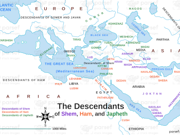
This map illustrates the dispersion of Noah's sons, Shem, Ham, and Japheth, according to the genealogical table in the book...
Read More

This map illustrates the dispersion of Noah's sons, Shem, Ham, and Japheth, according to the genealogical table in the book...
Read More
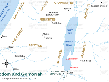
While the exact location of Sodom and Gomorrah is unknown, this map might show the region traditionally associated with these...
Read More
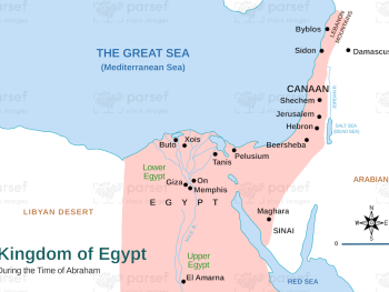
This map depicts the Egyptian kingdom during the biblical era, potentially highlighting its capital city and major administrative centers....
Read More
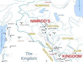
This map depicts the possible location of the kingdom of Nimrod, a figure mentioned in Genesis 10, though the exact...
Read More
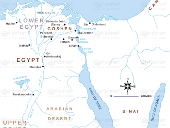
This map illustrates the Nile River and surrounding areas as referenced in the book of Genesis, potentially highlighting Egypt's role...
Read More
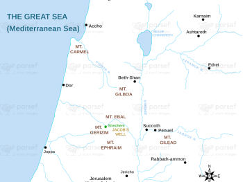
This map provides a detailed view of Shechem, a significant city in Canaan mentioned in the book of Genesis, associated...
Read More
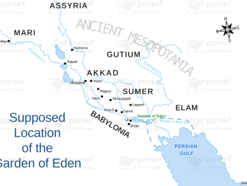
While the exact location of the Garden of Eden is not known, this map might depict a symbolic representation based...
Read More
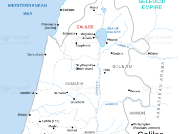
This map portrays Galilee during the Maccabean Revolt, highlighting its involvement in the struggle for Jewish independence....
Read More
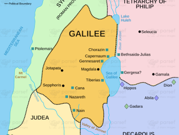
This map depicts Galilee during Jesus' ministry, showcasing the towns and villages he visited and the geographical context of his...
Read More
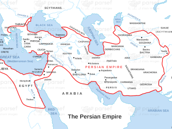
This map focuses on the administrative structure of the Persian Empire during Ezra's time, highlighting his position within the imperial...
Read More
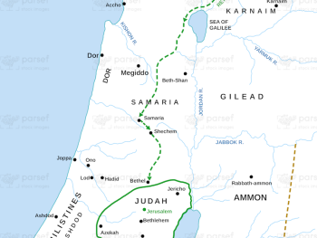
This map traces the route Ezra likely took as he led a group of exiles back to Jerusalem for its...
Read More
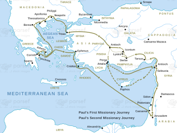
This map combines the routes of Paul's first and second missionary journeys, showcasing his extensive travels and areas of influence....
Read More
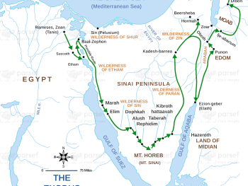
This map provides a detailed illustration of the Israelites' possible route during the Exodus, including potential stopping points and geographical...
Read More
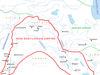
This map illustrates the Neo-Babylonian Empire during the time of the prophet Ezekiel, highlighting the context of his prophecies and...
Read More
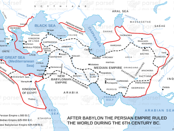
This map depicts the Persian Empire during the 6th century BC, the time of Ezra's mission to rebuild Jerusalem....
Read More
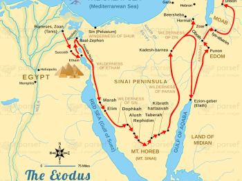
This map illustrates the route the Israelites likely took during their escape from Egypt, potentially including significant landmarks....
Read More
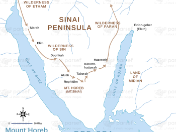
This map focuses on Mount Horeb (also known as Sinai), the location where Moses received the Ten Commandments according to...
Read More
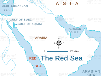
This map depicts the Red Sea and surrounding areas during the Israelites' exodus from Egypt, highlighting the path they likely...
Read More